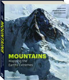
MOUNTAINS: Mapping the Earth's Extremes
Using high-resolution satellite data, scientists have created a series of incredibly accurate digital 3D maps of mountain landscapes. These digital models have been used to generate amazing photorealistic images, creating virtual landscapes seen from previously impossible viewpoints in an unprecedented degree of detail.
Format: Hardbound
Pages: 241
Publisher: Thames & Hudson
Size: 10¾x12½ inches
ISBN: 9780500518892
Item #: 1118234
Published at $55.00
Your Price
$12.95
(Save $42.05)


